Plan buttons
February 10, 2019
Furkot displays several buttons at the top of the Plan drawer: they allow you to add a new stop, reverse trip itinerary and affect which stops are displayed in the Plan drawer.
Use the add new stop button to add a stop to your trip.
Reverse your trip itinerary by clicking the reverse button.
The filter button enables you to control what you see in the Plan drawer. You can decide which stops are displayed, what type of distance and time is visible directly for each route and which options are presented when you view day, stop, and route settings.
Use the Display Stops option to restrict which stops are displayed in the Plan drawer: you can see pass-through points, regular stops, refueling stops, overnight lodgings (of one or more nights), only stops with a specific tag (selected at the bottom of the drawer) or any combination of thereof.
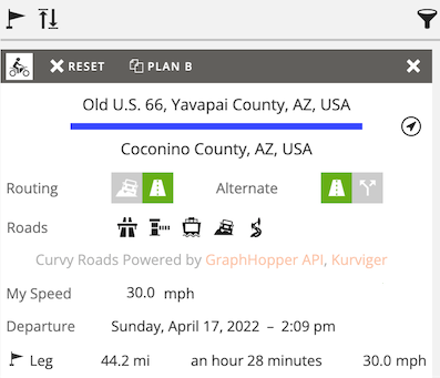
When planning a trip it is important to know how far apart places are and how long it takes to travel between them. For each route between stops Furkot calculates distance and travel time for the leg (from the previous stop), since last refuel (from the previous refueling stop), for the day (from the previous night lodging) and for the trip (from the trip starting point). All types of distance and time are displayed as part of route settings when you select the route. One of them is also displayed directly in the Plan drawer for each route and in the small info popping up when you mouse over a route - you can select which one by changing the Distance from option.
If you are traveling and using Furkot to help navigate your trip, you can optimize Furkot for Navigation to view your current location and heading on the map. When Furkot is optimized for navigation, the Plan drawer displays only the address and coordinates of each stop.
You may also want to optimize Furkot for Navigation when using a smaller phone or tablet: there will be less info displayed for each stop, but you'll be able to see nearby stops on a smaller screen.
When planning trip in a mountainous terrain, you may be interested to know the gradient of a road. Optimize Furkot for Mountains to see the elevation profile for selected route. Displaying elevation profile is a feature available exclusively to Furkot Pass holders.
Optimizing Furkot for Advanced use mode gives you access to additional day, stop, and route settings. They are particularly useful if you plan longer trips, with multiple modes of transportation and you want a direct control over routing and timing of your trip legs.
| Quick reference | |||||||||||||||||||||||||||||||
|---|---|---|---|---|---|---|---|---|---|---|---|---|---|---|---|---|---|---|---|---|---|---|---|---|---|---|---|---|---|---|---|
| Add a new stop | |||||||||||||||||||||||||||||||
| Reverse trip itinerary | |||||||||||||||||||||||||||||||
| Select what is displayed in the Plan drawer | |||||||||||||||||||||||||||||||
|
|||||||||||||||||||||||||||||||


