Print the trip
June 28, 2019
Furkot supports printing your trip. But we recognize the limitations of a printout and recommend to use it as a backup only. There are better options to navigate your trip plan or to share it with other people.
Printing a trip plan to take it with you is insufficient for any trip beyond a few stops: things don't always go according to plan and you cannot change the printout to adapt.
You can take your trip plan on the road with your smartphone and use navigation apps to follow the plan. You can export your trip and transfer it onto the GPS unit or navigation app to follow the exact routes you planned.
To handle guidance in a more traditional fashion, you'll need a professionally printed map with enough detail to reroute, in addition to the printout of your trip plan. If you want to support Furkot, please consider purchasing your maps via this link to Amazon.
If you want to show your trip to other people, Furkot has several sharing options that are much better than sending attachments around: you can publish a tripshot, you can let friends view all the details of your trip or you can let them plan it with you.
Printing instructions
Before you print your trip, make sure it has no warnings: while some - like the warning about weekends - are merely informational, most are a sign that something is not quite right with your trip and the printout may not be as you expect it.
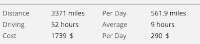
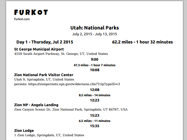
You can just use the standard Print option on your browser to print your road trip plan. Furkot will print a list of stops grouped by day, arrival and departure time, the address of each stop and your notes for the trip.
If your browser and operating system supports Print preview you will be able to see the trip itinerary before you print it.
If you want to include detailed, turn-by-turn directions in your printout, click on the print button in the Trip drawer and select the option turn-by-turn directions. Printing turn-by-turn directions is a feature available exclusively to Furkot Pass holders.
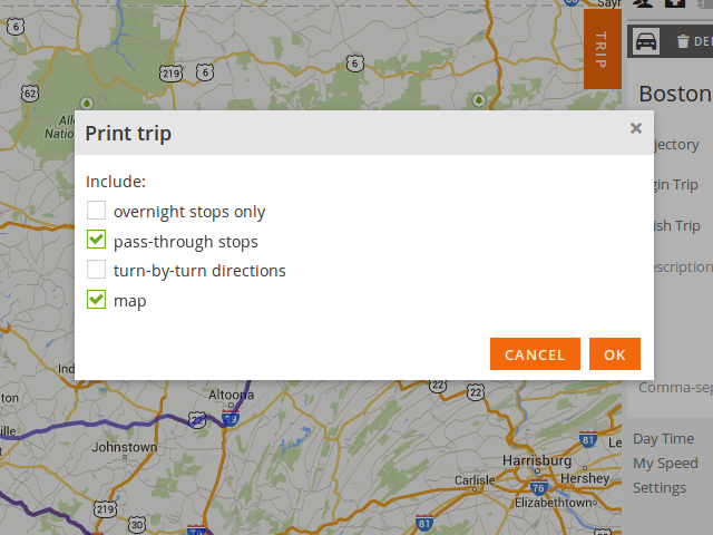
Your printout will also contain a map when the option map is selected. The map included in the printout is in the same scale as displayed on the screen. If your screen dimensions exceed the size of the paper page only part of the map will be visible in the printout (starting from the upper left corner). Pan and zoom your map and/or change the orientation of the page in the printer settings for better results. You can also zoom and pan the map to print part of your trip map in a greater detail.
Due to browser limitations, printing the map is only available in Chrome.
You can also restrict the printout to overnight stops only or expand it to cover pass-through stops (points of no duration anchoring the route).