What happened to Google Maps
April 21, 2019
On Monday, July 16, 2018 new pricing plan for Google Maps Platform (map and related APIs that Furkot heavily relies upon) went into effect. It is a radical price increase: Google decided to raise the prices tenfold and decrease its free service quotas by 90%. As a result, Furkot is no longer using Google mapping API.
Google's previous pricing policy made it possible for us to offer Furkot free of charge. The change in pricing means that we would have to pay about 20 times more than before. Sadly, there is no way we can absorb that much of a cost increase. And since we want to continue offering free access to as many Furkot features as we can, we are discontinuing use of Google mapping API.
Furkot has been employing Google mapping API to implement the following features, all of which are either switching to a different provider, or are temporarily suspended:
- Road map
- Street view
- Satellite imagery
- Terrain features (topo map)
- Routing engine
- Geocoding
- Text search / autocomplete
- Stop elevation / route elevation profile
- Campgrounds and hotels
- Restaurants
- Trip map thumbnails
- Weather overlay on map
We realize these changes may result in a decrease of Furkot functionality for some period of time. We apologize for the inconvenience. Rest assured we will continue to look for alternatives either using third party services or developing in-house solutions.
Road map
Road map provided by Google Maps Script API is replaced by OpenStreetMap. This is the same map that has been available in Furkot for some time as alternate and offline map. This change covers maps displayed by Published tripshot and the Ask for advice board as well.
Street view
Street view is an integral part of Google maps and is being suspended until we find a cost-effective way of supporting it again.
Satellite imagery
While Google provides excellent satellite imagery it's not the only provider of this type of data. We are now offering satellite imagery from a different vendor as an exclusive benefit for Furkot Pass holders.
Terrain features (topo map)
We have replaced a terrain map provided by Google by a topo map with contour lines and hill shading supplied by a different vendor as an exclusive benefit for Furkot Pass holders.
Routing engine
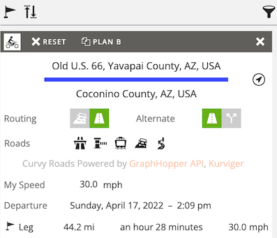
Routing engine is a workhorse of Furkot. We have been predominantly relying on Google Directions API in this respect but had supplemented its functionality by a selection of others employed for alternate and seasonally closed routes. We are phasing out Google routing engine and bringing the other options - GraphHopper, openroute service and Stadia Maps -- to replace it.
We are keeping currently supported routing options (avoid highways and tolls) and travel modes (biking and pedestrian in addition to motorized traffic) in place, although the new routing engines have a slightly different coverage and may return different results. We are using this opportunity to improve routing over seasonally closed roads.
Furkot's alternate routes could be used to display routes different from those offered by Google Directions API. With the change of the main routing engine, the alternate and primary routes will be calculated using the same underlying data and consequently may not be different in many cases. We are exploring options offered by routing engines to differentiate the alternate and primary routes.
Google Directions API was fast enough to allow Furkot to display potential routes in real time when dragging stops and route points. The replacement may not guarantee a smooth experience in all cases. You will still be able to drag routes and stops, but Furkot will display a potential route less often while dragging.
Geocoding
Google Geocoding API allowed us to convert a textual address to geographic coordinates and vice-versa. Luckily there are services specializing solely in geocoding at very reasonable prices. We are looking at a combination of the following vendors as potential replacements: GraphHopper, openroute service.
Text search / autocomplete
Furkot was using Google Autocomplete functionality to aid editing stop names and addresses and also in the search bar in the Ask for advice board. The main difference between Google Autocomplete and the new geocoding engines is that the latter require a hint to prioritize the results. Consequently when you type a name or address, you'll need to pan and zoom the map to cover the area to include broadly the place you are looking for.
Stop elevation / route elevation profile
Furkot depended on Google Elevation API to display the elevation of stops and elevation profile of routes. We found a replacement data source for the elevation profile and reinstated it as an exclusive benefit for Furkot Pass holders.
The elevation of stops remains temporarily suspended while we are evaluating elevation data sources for that purpose.
Campgrounds and hotels
Google Places API used to have a generous free limit of 150,000 requests a day. Furkot was using it to supplement its offering of campgrounds and independent hotels, especially in places where our lodging partners fell short.
We are discontinuing Google as a middleman for campgrounds and independent hotels and are working on broadening our selection by striking new direct partnerships.
Lodging providers share their revenue with us in exchange for helping Furkot users find their lodging accommodations. This is how Furkot makes money and stays mostly free. Unfortunately not all lodging providers see advantages of such a reciprocal arrangement. If your preferred lodging provider is one of those, feel free to contact them and encourage them to work with Furkot.
Restaurants
We are replacing restaurants provided until now by Google Places API by Foursquare and Yelp in addition to curated collections like Roadfood.
Trip map thumbnails
Trip map thumbnails displayed in the My Trips list are small renderings of a trip map. Their implementation was based on Google Maps Static API which allowed embedding image representation of maps in a webpage. We are using Stadia Maps as a replacement which slightly changes the trip map thumbnails look-and-feel.
Weather overlay on map
We are temporarily removing the weather overlay on map and we will consider bringing it back at a later date.